

Table of Contents
- What to Look for in Offline Map Apps for Overlanding
- How to Use Offline Maps for Off-Roading
- Rugged Tablets for Overlanding: Why Dedicated Hardware Wins
- Offline Map Apps vs. Dedicated GPS: Which Do You Need?
- Overlanding Navigation Best Practices for Remote Terrain
- Subscription Models vs. Free Alternatives
- Conclusion
- Frequently Asked Questions
Last Updated: September 18, 2026
What to Look for in Offline Map Apps for Overlanding
Reliable offline map apps for overlanding are navigation tools that store map data directly on your device, letting you plan routes and track position without any cellular signal.
The best apps share a few core traits: true offline caching, topographic detail, and low battery draw. Everything else is secondary.
Essential Features: Topographic Maps and Trail Difficulty
Topographic maps show elevation changes, ridgelines, and drainage patterns that a standard road map flattens out. For overlanding, that detail determines whether a route is passable or a dead end.
Trail difficulty ratings matter just as much. Look for apps that flag routes by vehicle class, so a UTV trail doesn't get confused with a full-size overlanding route.
- Vector maps for smaller file sizes and faster rendering
- Raster maps for satellite imagery and scanned USGS quads
- Elevation profiles for planning fuel and water stops
- Point-of-interest layers for dispersed camping and trailheads
Hardware-Software Integration and Battery Optimization
Software is only half the equation. A phone running a navigation app in direct sun while charging will overheat and throttle, which is a common mistake riders make on long hauls.
Battery optimization starts with the display. Lower brightness, disable background sync, and cache maps before you leave the trailhead. A dedicated device with a sunlight-readable screen draws less power than a phone maxed out at full brightness.
Bureau of Land Management recreation and travel management guidance
How to Use Offline Maps for Off-Roading
Using offline maps for off-roading comes down to three habits: download before you leave, verify the data covers your route, and carry a backup. Most failures trace back to skipping one of those steps.
Downloading Maps and Managing Offline Caching
Offline caching is the process of saving map tiles, elevation data, and POIs to your device's local storage. Download the full region, not just the corridor you plan to ride, because detours happen.
Importing and Exporting GPX Files for Route Planning
GPX files are the universal format for sharing waypoints, tracks, and routes between apps and devices. If your app can't import or export GPX, you're locked into one ecosystem.
- Export your planned route before the trip
- Import community tracks from forums or riding groups
- Verify the track matches current trail conditions
- Keep a paper backup of critical coordinates
Rugged Tablets for Overlanding: Why Dedicated Hardware Wins
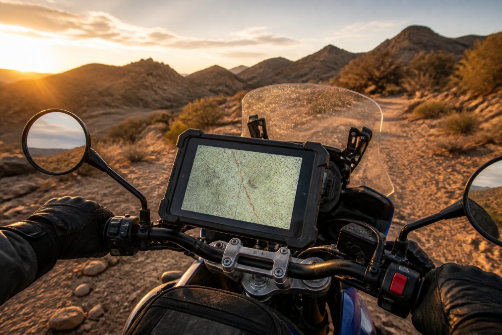
A dedicated rugged tablet survives conditions that kill a phone. Vibration, dust, and direct sun are the three failure points, and consumer hardware wasn't built for any of them.
Grit Adventure Tab builds GPS-enabled tablets for exactly this environment. The screens stay readable in full sun, the housings resist vibration and dust, and the mounting brackets fit motorcycles and UTVs. No phone tethering, no cellular dependency.
| Factor | Smartphone | Rugged Tablet |
|---|---|---|
| Sunlight readability | Poor | High |
| Vibration tolerance | Low | High |
| Battery life under load | Short | All-day |
| Mounting options | Limited | Universal brackets |
| Offline navigation | App-dependent | Built-in |
Offline Map Apps vs. Dedicated GPS: Which Do You Need?
The honest answer is that most overlanders need both, but they serve different jobs. A dedicated GPS unit is simple and durable but limited in map flexibility. A tablet running offline map apps gives you route planning, satellite imagery, and GPX interoperability.
If you already carry a phone with offline maps, a tablet earns its place through screen size, mounting stability, and battery endurance on multi-day expeditions.
Overlanding Navigation Best Practices for Remote Terrain
Overlanding navigation best practices come down to redundancy and preparation. Never rely on a single device, and never assume a route is unchanged since the last rider passed through.
- Carry two navigation sources with independent power
- Record a track, not just a route, so you can backtrack
- Share your planned route and expected return time
- Check motor vehicle use maps for closures before you ride
Emergency SOS Features and Data Privacy
Emergency SOS features vary widely between apps and devices. Satellite messengers and some tablets offer two-way emergency communication, but coverage and subscription terms differ, so verify what works in your riding area before you depend on it.
Data privacy matters too. Location sharing features can broadcast your position to other users. Review your app's sharing defaults and turn off public tracking unless you want it.
National Park Service backcountry safety guidance
Subscription Models vs. Free Alternatives
Free offline map apps exist, and some are genuinely capable. The trade-off is usually map freshness, layer depth, and support.
Subscription tiers typically add satellite imagery, frequent map updates, and premium layers like property boundaries. For occasional riders, free may be enough. For multi-day expeditions into remote backcountry, the paid tier usually pays for itself in avoided wrong turns.
Conclusion
Remote terrain punishes gear that wasn't built for it. Phones overheat, mounts fail, and screens wash out in direct sun exactly when you need them most.
Grit Adventure Tab exists for that gap. Our tablets run fully offline with no cellular signal required, use sunlight-readable displays, and mount to motorcycles and UTVs with universal brackets. They're built for vibration, dust, and long days on the trail.
U.S. Forest Service motor vehicle use maps
Explore Grit Tab and ride with navigation you can actually trust when the signal drops.
Frequently Asked Questions
Can you use onX Offroad offline?
Yes, onX Offroad allows you to download maps for offline use, but you must save specific areas before you lose cellular service. The app caches topographic maps, trail data, and property boundaries so you can navigate without a signal. However, offline functionality requires planning ahead. Download your route and surrounding terrain at home or at base camp. Once downloaded, you can view maps, track your location via GPS, and follow routes even in remote areas with no coverage.
What is the best free app for overlanding?
Free options like Gaia GPS's basic tier and Backcountry Navigator offer offline map downloads and GPS tracking. These apps work well for occasional trips, but they often limit map layers, offline storage, or advanced features like property boundaries. For serious overlanding, paid tiers or dedicated hardware provide more reliable offline caching, larger screen visibility, and better battery management. Start with a free app to test your workflow, then upgrade if you need more map detail or rugged hardware.
How do I download offline maps for remote expeditions?
Open your map app, select the region you plan to explore, and choose the download or offline caching option. Set the map detail level to balance storage space and clarity. For multi-day trips, download a corridor along your entire route plus a buffer for detours. Use Wi-Fi before you leave. Verify the download by switching your device to airplane mode and checking that the map still loads. Store extra maps on a microSD card if your device supports it.
Do I need a dedicated GPS device or just a smartphone app for overlanding?
A smartphone works for short trips in mild conditions, but it has limits: battery drain, overheating in direct sun, and fragile screens. Dedicated rugged tablets for overlanding offer sunlight-readable displays, vibration resistance, and all-day battery life. They also handle dust and water better. If you ride rocky trails or travel multi-day routes, a dedicated device prevents the frustration of a dead phone or unreadable screen. Many riders use both: phone as backup, tablet as primary navigation.
What should I look for in offline map apps for overlanding?
Prioritize topographic maps, public land boundaries, and trail difficulty ratings. Check if the app supports GPX file import and export for route planning. Offline caching must be reliable, and the app should let you download large regions without losing detail. Battery optimization matters, so look for apps that dim the screen or pause GPS when idle. Also confirm the app works with rugged tablets for overlanding, since hardware-software integration affects performance in dust, vibration, and heat.
How can I extend battery life when using offline map apps for overlanding?
Turn on airplane mode to stop cellular and Wi-Fi scanning, which drains power in weak-signal areas. Lower screen brightness or use a sunlight-readable tablet that doesn't need max brightness. Close background apps and disable auto-sync. Pre-download maps so the app isn't processing data. Use a dedicated GPS chip if your tablet has one, as it uses less power than phone-based GPS. Carry a portable power bank or hardwire a charger to your vehicle for multi-day trips.
The challenge with offline navigation isn't finding an app. It's finding hardware that survives the ride. Grit Adventure Tab builds GPS-enabled tablets with fully offline navigation, sunlight-readable displays, and rugged mounting for motorcycles and UTVs. Explore Grit Tab and head into the backcountry with a setup built for the conditions.